
It is always difficult to organise a camp that ties in with both those who go to school in Scotland and those who go to school in England due to the different holidays. 1st Flodden must be one of a very small number of Scout Groups that has to contend with this 'problem'!
For that reason, combined with weather conditions and differing requirements of Scouts and Senior Scouts, we decided to run two activity days on Sat 19th and Sunday 20th (the first or last weekend of school half-term holiday!)
Scouts attended the first of these days which was very cold, wet, windy and snowy, much to their delight! The ascent of Ros Castle, the site of an iron age hill fort, was managed with a sense of excitement and adventure. At the summit, in the shelter of the wall of the viewing platform, Scouts oriented their maps and took bearings to the next point on their hike route. We then had to trudge across the bleak moorland of Hepburn and Bewick Moors via more ancient hill forts, defined paths and deep heather; set new bearings to identifiable map and ground features to continue the journey. The going was miserable with everyone getting cold and wet. Eventually we reached the ruins of Blawearie, where we stopped to have our packed lunches in shelter. With food in our bellies and improving weather conditions, everyone warmed up and the mood became much happier and cheerful with laughter abounding. In excellent spirit we headed back to where our transport home awaited.
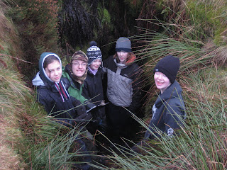
It was the turn of Senior Scouts on the Sunday, with much better conditions than the previous day, despite low cloud cover. The start point today was Quarry Farm from where a bearing to the Cateran Hole was taken, distance calculated with the task of finding it given. After a few checks on the map and identifying the shape of the ground we eventually found what we were looking for. Needless to say, all Seniors felt the need to explore this subterranean cave. From here we headed across Cateran Hill towards Blawearie, stopping occasionally to check maps or to carry out a resection or line resection to identify our exact location on the map. Walls were used as handrails as an important navigation aid. Again, lunch was devoured in the fabulous setting of Blawearie, before heading back to Quarry Farm with more navigation tasks carried out on the way.

